
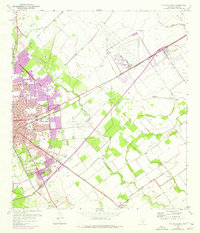
1952 Map of Victoria East
USGS Topo · Published 1953About this map
The city of Victoria anchors this mid-century Texas landscape, serving as a hub for both education and the regional fossil fuel industry. The presence of Victoria College and various municipal institutions like the Hospital and Orphanage suggests a growing urban center, while the outskirts are marked by intensive energy development, including an active Oil Field and numerous Oil Wells and Oil Tanks. The Southern Pacific railroad cuts a straight line northeast toward Telferner, paralleling the development of the era's roadway network.
Find a feature on this map
36 named features on this map. Tap any name to fly to it.
Don’t see what you’re looking for? This feature index may not catch every label — zoom into the map to look around manually.
Map Details
Editions of this 1952 Victoria East Map
2 editions found
Other maps of this area

1951 · Bloomington
USGS Topo · 1:24,000

1951 · Inez NW
USGS Topo · 1:24,000

1951 · Inez
USGS Topo · 1:24,000

1952 · Marcado Creek
USGS Topo · 1:24,000

1952 · Placedo
USGS Topo · 1:24,000

1953 · Beeville
USGS Topo · 1:250,000

1956 · Beeville
USGS Topo · 1:250,000

1960 · Beeville
USGS Topo · 1:250,000

1962 · Raisin
USGS Topo · 1:24,000

1963 · Nursery
USGS Topo · 1:24,000