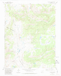
1984 Map of Victoria Lake
USGS Topo · Published 1984About this map
The Continental Divide winds through this high-altitude landscape on the boundary of Conejos County and Archuleta County. This 1984 edition illustrates a pristine watershed where the South Fork Conejos River and the East Fork Rio Chama originate from glacial basins. The map captures the meeting of three major protected areas: the Rio Grande National Forest, San Juan National Forest, and the South San Juan Wilderness. Notable for its many high-country water bodies, the survey documents Victoria Lake, Timber Lake, and the remote Chama Lake. A segment of the Tierra Amarilla Grant Boundary cuts across the southern reach, providing a look at historical land tenure and surveying lines that persist in the modern era. The presence of numerous pack trails suggests a landscape shaped by seasonal access rather than permanent settlement.
Find a feature on this map
41 named features on this map. Tap any name to fly to it.
Don’t see what you’re looking for? This feature index may not catch every label — zoom into the map to look around manually.
Map Details
Editions of this 1984 Victoria Lake Map
2 editions found
Other maps of this area

1913 · Summitville
USGS Topo · 1:125,000

1915 · Summitville
USGS Topo · 1:125,000

1922 · Conejos
USGS Topo · 1:125,000

1945 · Durango
USGS Topo · 1:250,000

1953 · Durango
USGS Topo · 1:250,000

1954 · Durango
USGS Topo · 1:250,000

1957 · Chama Peak
USGS Topo · 1:62,500

1961 · Durango
USGS Topo · 1:250,000

1963 · Durango
USGS Topo · 1:250,000

1966 · Durango
USGS Topo · 1:250,000