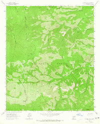
1963 Map of Victoria Park
USGS Topo · Published 1965About this map
The Black Range forms a formidable geographic spine through this portion of the Gila National Forest, dividing the headwaters of the Mimbres River from the drainages of Animas Creek. This high-altitude landscape is defined by its complex network of seasonal water sources and canyons, including Massacre Canyon and Victoria Canyon. The prominence of Victoria Park Mountain and McKnight Mountain anchor the topography, where numerous named springs like Geronimo Spring and Marshall Spring served as vital points of reference in an otherwise arid environment. The presence of features such as Negro Bill Spring and Katy Place Spring suggests the legacy of early stockmen and settlers who navigated these corridors before the area was fully integrated into the national forest system.
Find a feature on this map
46 named features on this map. Tap any name to fly to it.
Don’t see what you’re looking for? This feature index may not catch every label — zoom into the map to look around manually.
Map Details
Editions of this 1963 Victoria Park Map
2 editions found

Other maps of this area

1935 · Hillsboro
USGS Topo · 1:48,000

1940 · Hillsboro
USGS Topo · 1:62,500

1954 · Tularosa
USGS Topo · 1:250,000

1955 · Las Cruces
USGS Topo · 1:250,000

1956 · San Lorenzo
USGS Topo · 1:62,500

1958 · Las Cruces
USGS Topo · 1:250,000

1958 · Tularosa
USGS Topo · 1:250,000

1963 · Bonner Canyon
USGS Topo · 1:24,000

1963 · Reeds Peak
USGS Topo · 1:24,000
1963 · Hay Mesa
USGS Topo · 1:24,000