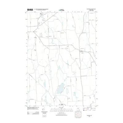
2013 Map of Victory
USGS Topo · Published 2013About this map
Victory and Red Creek serve as the primary hubs in this corner of Wayne County, where agricultural lands meet the intricate wetlands and creek systems of Central New York. The landscape is characterized by a high density of rural burial grounds, including the Victory Union Cem, Old Westbury Cem, and Southside Cem, providing a clear record of early family settlement patterns. Terrain features like Cuddeback Hill and Hogback Hill rise above the drainage basins of Sterling Cr and Blind Sodus Cr, which flow northward toward the Great Lakes. To the south, the waters of Duck Lake and Spring Lake dominate the geography, connected by the Spring Lake Outlet. The presence of Paradise Airport and Snyders Tree Farm illustrates the modern blend of aviation and land-use that defines the region today.
Find a feature on this map
93 named features on this map. Tap any name to fly to it.
Don’t see what you’re looking for? This feature index may not catch every label — zoom into the map to look around manually.
Map Details
Editions of this 2013 Victory Map
This is the sole edition of this map. No revisions or reprints were ever made.
Other maps of this area

1900 · Oswego
USGS Topo · 1:62,500

1902 · Sodus Bay
USGS Topo · 1:62,500

1902 · Clyde
USGS Topo · 1:62,500

1902 · Weedsport
USGS Topo · 1:62,500

1943 · Montezuma
USGS Topo · 1:31,680

1943 · Cato
USGS Topo · 1:31,680

1943 · Savannah
USGS Topo · 1:31,680

1943 · Hannibal
USGS Topo · 1:31,680

1943 · Weedsport
USGS Topo · 1:31,680

1943 · Fair Haven
USGS Topo · 1:31,680