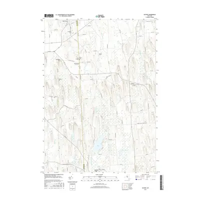
2016 Map of Victory
USGS Topo · Published 2016About this map
The boundary between Wayne Co and Cayuga Co bisects this landscape of glacial drumlins and wetlands. Small settlements like Red Creek in the north and Westbury near the center anchor a network of rural roads, while the village of Victory sits further east along Old State Rd. The terrain is defined by elongated elevations such as Cuddeback Hill and Hogback Hill, which rise above a complex hydrography including Duck Lake, Mud Pond, and the Spring Lake Outlet. Numerous burial grounds are documented here, providing valuable data for genealogists, including Old Westbury Cem, New Westbury Cem, and Victory Union Cem. For aviation enthusiasts, Paradise Airport appears as a distinct landmark tucked between Timerson Rd and Upton Rd, illustrating the persistence of private airstrips in the Finger Lakes region's periphery.
Find a feature on this map
84 named features on this map. Tap any name to fly to it.
Don’t see what you’re looking for? This feature index may not catch every label — zoom into the map to look around manually.
Map Details
Editions of this 2016 Victory Map
This is the sole edition of this map. No revisions or reprints were ever made.
Other maps of this area

1900 · Oswego
USGS Topo · 1:62,500

1902 · Sodus Bay
USGS Topo · 1:62,500

1902 · Clyde
USGS Topo · 1:62,500

1902 · Weedsport
USGS Topo · 1:62,500

1943 · Montezuma
USGS Topo · 1:31,680

1943 · Cato
USGS Topo · 1:31,680

1943 · Savannah
USGS Topo · 1:31,680

1943 · Hannibal
USGS Topo · 1:31,680

1943 · Weedsport
USGS Topo · 1:31,680

1943 · Fair Haven
USGS Topo · 1:31,680