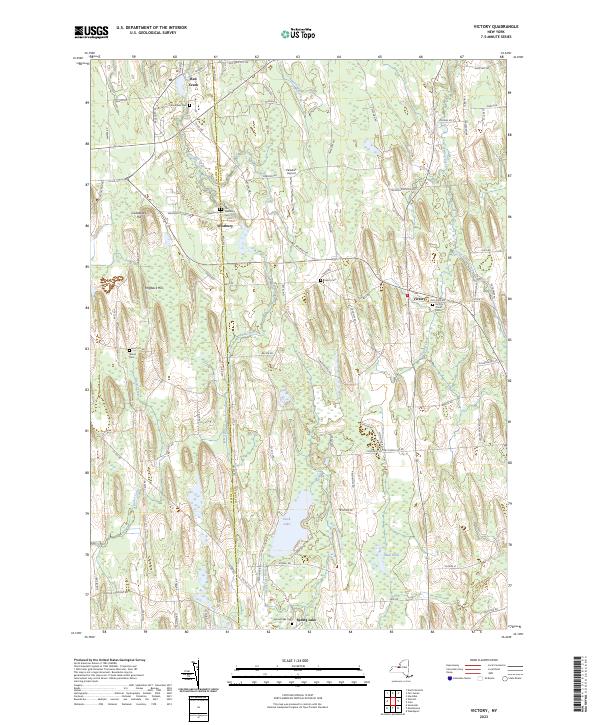
2023 Map of Victory
USGS Topo · Published 2023About this map
Victory and its surrounding hamlets in Wayne and Cayuga counties are defined by a distinctive glaciated landscape of north-south drumlins. This 2023 update reveals the modern rural character of several small settlements including Westbury, Spring Lake, and Red Creek, all set against a complex network of wetlands and watercourses. Small family-named landmarks like Cuddeback Hill and Hogback Hill rise above the lowlands, while several historical burial grounds, such as French Cem and Victory Union Cem, provide important touchstones for local genealogists. The map also identifies the Paradise Airport and a dense patchwork of minor roads like Muckland Ave and Slyburg Rd that navigate the marshy terrain between Duck Lake and Mud Pond. This survey effectively traces the continued agricultural and residential patterns that have shaped this portion of Central New York for generations.
Find a feature on this map
90 named features on this map. Tap any name to fly to it.
Don’t see what you’re looking for? This feature index may not catch every label — zoom into the map to look around manually.
Map Details
Editions of this 2023 Victory Map
This is the sole edition of this map. No revisions or reprints were ever made.
Other maps of this area

1900 · Oswego
USGS Topo · 1:62,500

1902 · Sodus Bay
USGS Topo · 1:62,500

1902 · Clyde
USGS Topo · 1:62,500

1902 · Weedsport
USGS Topo · 1:62,500

1943 · Montezuma
USGS Topo · 1:31,680

1943 · Cato
USGS Topo · 1:31,680

1943 · Savannah
USGS Topo · 1:31,680

1943 · Hannibal
USGS Topo · 1:31,680

1943 · Weedsport
USGS Topo · 1:31,680

1943 · Fair Haven
USGS Topo · 1:31,680