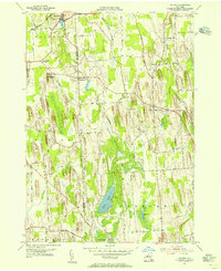
1954 Map of Victory
USGS Topo · Published 1956About this map
Glacial landforms dominate this mid-century portrait of the Wayne and Cayuga county line, where the landscape is defined by a dense field of north-south drumlins. The village of Red Creek sits at the northern edge of this terrain, while the rural interior is dotted with small settlements like Westbury and Spring Lake. Agriculture and aviation intersect at the Schuler Farms Landing Field, providing a unique landmark among the woodlots and ridges.
Find a feature on this map
31 named features on this map. Tap any name to fly to it.
Don’t see what you’re looking for? This feature index may not catch every label — zoom into the map to look around manually.
Map Details
Editions of this 1954 Victory Map
This is the sole edition of this map. No revisions or reprints were ever made.
Other maps of this area

1900 · Oswego
USGS Topo · 1:62,500

1902 · Sodus Bay
USGS Topo · 1:62,500

1902 · Clyde
USGS Topo · 1:62,500

1902 · Weedsport
USGS Topo · 1:62,500

1943 · Montezuma
USGS Topo · 1:31,680

1943 · Cato
USGS Topo · 1:31,680

1943 · Savannah
USGS Topo · 1:31,680

1943 · Hannibal
USGS Topo · 1:31,680

1943 · Weedsport
USGS Topo · 1:31,680

1943 · Fair Haven
USGS Topo · 1:31,680