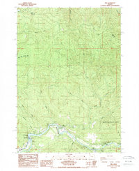
1988 Map of Vida
USGS Topo · Published 1988About this map
The Mc Kenzie River winds through the southern portion of this landscape, serving as a primary corridor for recreation and infrastructure in the 1980s. The settlement of Vida sits near the iconic Goodpasture Bridge (Covered), a landmark that bridges the gap between the river's bank and the forested hills to the north. This area is heavily defined by its water management and conservation sites, including the Leaburg Dam and the Leaburg Fish Hatchery, which support the local ecology and economy.
Find a feature on this map
34 named features on this map. Tap any name to fly to it.
Don’t see what you’re looking for? This feature index may not catch every label — zoom into the map to look around manually.
Map Details
Editions of this 1988 Vida Map
This is the sole edition of this map. No revisions or reprints were ever made.
Other maps of this area

1934 · Mc Kenzie Bridge
USGS Topo · 1:96,000

1940 · Mc Kenzie Bridge
USGS Topo · 1:125,000

1951 · Sweet Home
USGS Topo · 1:62,500

1951 · Leaburg
USGS Topo · 1:62,500

1953 · Salem
USGS Topo · 1:250,000

1954 · Salem
USGS Topo · 1:250,000

1955 · Blue River
USGS Topo · 1:62,500

1955 · Cascadia
USGS Topo · 1:62,500

1960 · Salem
USGS Topo · 1:250,000

1962 · Salem
USGS Topo · 1:250,000