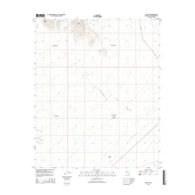
2015 Map of Vidal NW
USGS Topo · Published 2015About this map
The Colorado River Aqueduct carves a path through the southeastern corner of this arid landscape, a critical piece of water infrastructure cutting across the Mojave Desert. To the north, the sharp elevations of the Mopah Range dominate the topography, culminating at Negro Peak. This 2015 survey illustrates the isolation of the Vidal Valley, where the terrain is defined by dry drainage features like Vidal Wash. The intersection of modern engineering and a harsh natural environment is evident as the aqueduct traverses the basin, following a route largely parallel to the distant transportation corridors of Route 62 and Route 95. The map provides a clear record of the public land survey system grid, showing the township and range boundaries that organize this part of San Bernardino County.
Find a feature on this map
12 named features on this map. Tap any name to fly to it.
Don’t see what you’re looking for? This feature index may not catch every label — zoom into the map to look around manually.
Map Details
Editions of this 2015 Vidal NW Map
This is the sole edition of this map. No revisions or reprints were ever made.
Other maps of this area

1943 · Turtle Mts.
USGS Topo · 1:62,500

1943 · Vidal
USGS Topo · 1:62,500

1949 · Vidal
USGS Topo · 1:62,500

1950 · Vidal
USGS Topo · 1:62,500

1950 · Savahia Peak
USGS Topo · 1:62,500

1951 · Savahia Peak
USGS Topo · 1:62,500

1954 · Needles
USGS Topo · 1:250,000

1954 · Turtle Mountains
USGS Topo · 1:62,500

1954 · Rice
USGS Topo · 1:62,500

1956 · Needles
USGS Topo · 1:250,000