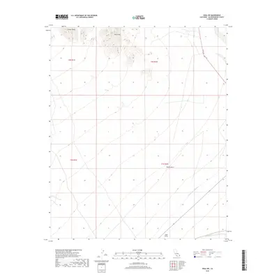
2018 Map of Vidal NW
USGS Topo · Published 2018About this map
The Mopah Range and Negro Peak dominate the northern landscape of this corner of the Mojave Desert, where high-elevation terrain transitions into the broad sweep of Vidal Valley. A critical piece of regional infrastructure, the Colorado River Aqueduct, cuts across the southeastern portion of the map, tracing a path through the arid lowlands. This survey illustrates the contrast between the unpopulated desert mountains and the engineered lines of modern transport and water management. US Rte 95 provides the primary north-south passage through this remote section of San Bernardino County, skirting the eastern edge of the peaks. The map reflects the enduring isolation of this region, punctuated only by the vital utility corridors that connect the Colorado River to the coastal plains.
Find a feature on this map
9 named features on this map. Tap any name to fly to it.
Don’t see what you’re looking for? This feature index may not catch every label — zoom into the map to look around manually.
Map Details
Editions of this 2018 Vidal NW Map
This is the sole edition of this map. No revisions or reprints were ever made.
Other maps of this area

1943 · Turtle Mts.
USGS Topo · 1:62,500

1943 · Vidal
USGS Topo · 1:62,500

1949 · Vidal
USGS Topo · 1:62,500

1950 · Vidal
USGS Topo · 1:62,500

1950 · Savahia Peak
USGS Topo · 1:62,500

1951 · Savahia Peak
USGS Topo · 1:62,500

1954 · Needles
USGS Topo · 1:250,000

1954 · Turtle Mountains
USGS Topo · 1:62,500

1954 · Rice
USGS Topo · 1:62,500

1956 · Needles
USGS Topo · 1:250,000