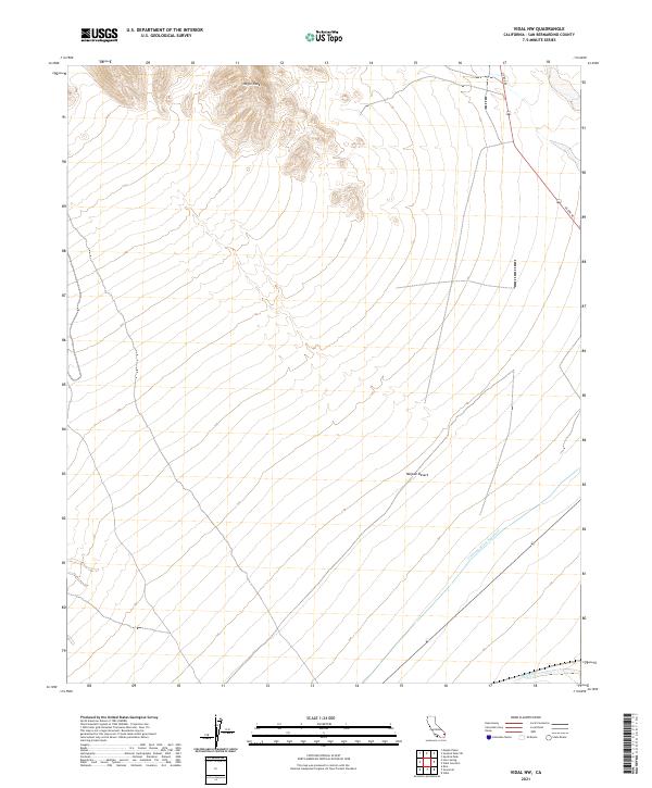
2021 Map of Vidal NW
USGS Topo · Published 2021About this map
Negro Peak dominates the northern landscape of this corner of the Mojave Desert in San Bernardino County. The arid terrain is defined by the engineering of the Colorado River Aqueduct, which cuts diagonally across the southern sections of the quadrangle. This vital infrastructure serves as a stark human imprint on the desert floor, alongside the drainage of Vidal Wash to the southeast. Transport through this open country relies on US Rte 95, which runs north-to-south, providing a primary link through the basin. The map illustrates the sparse settlement patterns typical of this region, where land is primarily organized by the Public Land Survey System, as seen in the prominent township and range boundaries including t2n r21e and t1n r22e.
Find a feature on this map
9 named features on this map. Tap any name to fly to it.
Don’t see what you’re looking for? This feature index may not catch every label — zoom into the map to look around manually.
Map Details
Editions of this 2021 Vidal NW Map
This is the sole edition of this map. No revisions or reprints were ever made.
Other maps of this area

1943 · Turtle Mts.
USGS Topo · 1:62,500

1943 · Vidal
USGS Topo · 1:62,500

1949 · Vidal
USGS Topo · 1:62,500

1950 · Vidal
USGS Topo · 1:62,500

1950 · Savahia Peak
USGS Topo · 1:62,500

1951 · Savahia Peak
USGS Topo · 1:62,500

1954 · Needles
USGS Topo · 1:250,000

1954 · Turtle Mountains
USGS Topo · 1:62,500

1954 · Rice
USGS Topo · 1:62,500

1956 · Needles
USGS Topo · 1:250,000