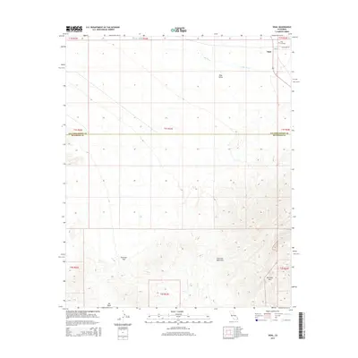
2015 Map of Vidal
USGS Topo · Published 2015About this map
The settlement of Vidal anchors the northern reaches of this Colorado Desert landscape, positioned near the junction of 95 and Old Parker Rd. This 2015 survey illustrates a desert community defined by its topography, where the Vidal Valley transitions into the steep, complex drainages of the Riverside Mountains to the south. Local history is marked by the presence of Holly Cemetery on the northeastern edge of the townsite. The terrain is dominated by the seasonal paths of the Vidal Wash and Big Wash, while the Riverside Pass provides a natural corridor through the southern peaks. The map also delineates the jurisdictional boundary where San Bernardino County meets Riverside County, cutting horizontally across the desert floor. This modern record details the sparse but critical infrastructure of a remote California desert outpost, from the layout of Main St to the surrounding public land survey divisions.
Find a feature on this map
21 named features on this map. Tap any name to fly to it.
Don’t see what you’re looking for? This feature index may not catch every label — zoom into the map to look around manually.
Map Details
Editions of this 2015 Vidal Map
This is the sole edition of this map. No revisions or reprints were ever made.
Other maps of this area

1911 · Parker
USGS Topo · 1:125,000

1931 · Moon Mtn
USGS Topo · 1:62,500

1932 · Moon Mtn
USGS Topo · 1:62,500

1942 · Blythe
USGS Topo · 1:250,000

1942 · MOON MTN
USGS Topo · 1:62,500

1943 · Parker
USGS Topo · 1:62,500

1943 · Vidal
USGS Topo · 1:62,500

1945 · Big Maria Mtns
USGS Topo · 1:62,500

1949 · Parker
USGS Topo · 1:62,500

1949 · Vidal
USGS Topo · 1:62,500