
1949 Map of Vidal
USGS Topo · Published 1963About this map
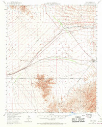
The Atchison Topeka and Santa Fe railroad serves as the primary artery through this desert corridor, connecting the small communities of Vidal and Grommet. Near the San Bernardino Base Line, Vidal Junction functions as a critical highway crossroads, noted here for its Plant Quarantine Station. The landscape is defined by the massive infrastructure of the Colorado River Aqueduct, which cuts across the northern terrain through a series of siphons and tunnels. To the south, the West Riverside Mountains and Riverside Mountains dominate the horizon, harboring remote operations like the Jacklin Mine, Jean Mine, and Gold Rice Mine. These labels provide a window into the mid-century mining and transit economy of the California desert, tracking the early path of the Blythe-Vidal Road before modern highway realignments.
Find a feature on this map
19 named features on this map. Tap any name to fly to it.
Don’t see what you’re looking for? This feature index may not catch every label — zoom into the map to look around manually.
Map Details
Editions of this 1949 Vidal Map
2 editions found
Other maps of this area

1911 · Parker
USGS Topo · 1:125,000

1931 · Moon Mtn
USGS Topo · 1:62,500

1932 · Moon Mtn
USGS Topo · 1:62,500

1942 · Blythe
USGS Topo · 1:250,000

1942 · MOON MTN
USGS Topo · 1:62,500

1943 · Whipple Mts.
USGS Topo · 1:62,500

1943 · Parker
USGS Topo · 1:62,500

1943 · Turtle Mts.
USGS Topo · 1:62,500

1943 · Vidal
USGS Topo · 1:62,500

1945 · Big Maria Mtns
USGS Topo · 1:62,500