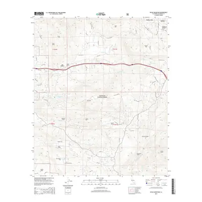
2015 Map of Viejas Mountain
USGS Topo · Published 2015About this map
Viejas Mtn and the Cuyamaca Mountains dominate this 2015 survey of San Diego County, where the topography transitions from the high peaks of Poser Mtn and Chiquito Peak down into the complex drainage of the Sweetwater River. The settlement pattern follows the contours of the land, with small communities such as The Willows, Hulburd Grove, and Stallion Oaks clustered along established routes like Alpine Blvd and Viejas Grade Rd.
Find a feature on this map
67 named features on this map. Tap any name to fly to it.
Don’t see what you’re looking for? This feature index may not catch every label — zoom into the map to look around manually.
Map Details
Editions of this 2015 Viejas Mountain Map
This is the sole edition of this map. No revisions or reprints were ever made.
Other maps of this area

1893 · El Cajon
USGS Topo · 1:62,500

1901 · Elcajon
USGS Topo · 1:62,500

1903 · Cuyamaca
USGS Topo · 1:125,000

1903 · Elcajon
USGS Topo · 1:62,500

1904 · Southern California Sheet No. 2
USGS Topo · 1:250,000

1939 · El Cajon
USGS Topo · 1:62,500

1942 · Potrero
USGS Topo · 1:48,000

1942 · El Cajon
USGS Topo · 1:62,500

1942 · Cuyamaca Peak
USGS Topo · 1:62,500

1943 · Jamul
USGS Topo · 1:62,500