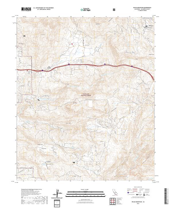
2021 Map of Viejas Mountain
USGS Topo · Published 2021About this map
Viejas Mtn and Cuyamaca Mountain overlook a complex network of valleys and canyons in this high-altitude section of the Cleveland National Forest. Small communities and named clusters like The Willows, Descanso, and Hulburd Grove concentrate along the northern corridors, while more secluded settlements such as Hidden Glen and Glen Lonely are found tucked into the southern drainages. The landscape is defined by its dramatic relief, with Japatul Valley and Lawson Valley providing relatively level ground amidst prominent peaks like Chiquito Peak and Poser Mtn.
Find a feature on this map
80 named features on this map. Tap any name to fly to it.
Don’t see what you’re looking for? This feature index may not catch every label — zoom into the map to look around manually.
Map Details
Editions of this 2021 Viejas Mountain Map
This is the sole edition of this map. No revisions or reprints were ever made.
Other maps of this area

1893 · El Cajon
USGS Topo · 1:62,500

1901 · Elcajon
USGS Topo · 1:62,500

1903 · Cuyamaca
USGS Topo · 1:125,000

1903 · Elcajon
USGS Topo · 1:62,500

1904 · Southern California Sheet No. 2
USGS Topo · 1:250,000

1939 · El Cajon
USGS Topo · 1:62,500

1942 · Potrero
USGS Topo · 1:48,000

1942 · El Cajon
USGS Topo · 1:62,500

1942 · Cuyamaca Peak
USGS Topo · 1:62,500

1943 · Jamul
USGS Topo · 1:62,500