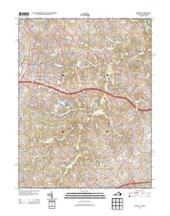
2013 Map of Vienna
USGS Topo · Published 2013About this map
Crowells Corner and Clarks Crossing anchor this landscape during a period of significant suburban expansion in Northern Virginia. The map documents the residential developments of Reston, including Lake Anne and Lake Newport, highlighting the planned community's distinctive layout. To the east, older place names like Browns Mill and Hickory Creek persist alongside newer neighborhoods like Shouse Village and Cinnamon Creek. The drainage of Difficult Run and its tributaries, such as Piney Run and Snakeden Br, provides the primary topographic structure between the major transit corridors of the Fairfax County Pkwy and Leesburg Pike. Local history is visible in the presence of Browns Chapel and Camp Crowell, showing the layer of civic and religious institutions that predate the modern shopping centers and office parks.
Find a feature on this map
69 named features on this map. Tap any name to fly to it.
Don’t see what you’re looking for? This feature index may not catch every label — zoom into the map to look around manually.
Map Details
Editions of this 2013 Vienna Map
This is the sole edition of this map. No revisions or reprints were ever made.
Other maps of this area

1890 · Mt. Vernon
USGS Topo · 1:125,000

1891 · Mt. Vernon
USGS Topo · 1:125,000

1893 · Frederick
USGS Topo · 1:125,000

1894 · Frederick
USGS Topo · 1:125,000

1894 · Mt. Vernon
USGS Topo · 1:125,000

1897 · Mt. Vernon
USGS Topo · 1:125,000

1900 · Washington
USGS Topo · 1:62,500

1908 · Rockville
USGS Topo · 1:62,500

1908 · Seneca
USGS Topo · 1:62,500

1915 · Fairfax
USGS Topo · 1:62,500