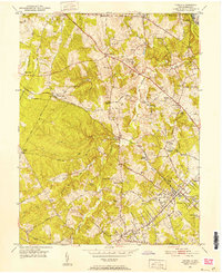
1951 Map of Vienna
USGS Topo · Published 1952About this map
Vienna and its surrounding countryside are captured here just as post-war suburbanization began to reshape Fairfax County. The Washington and Old Dominion Railway cuts a prominent diagonal across the landscape, serving as a primary corridor through Sunset Hills and Herndon. This era shows a transition from rural crossroads to residential clusters, with pockets of community life centered around small churches such as Antioch Ch and Beulah Ch, and local gathering spots like Crowells Corner and Moneys Corner.
Find a feature on this map
57 named features on this map. Tap any name to fly to it.
Don’t see what you’re looking for? This feature index may not catch every label — zoom into the map to look around manually.
Map Details
Editions of this 1951 Vienna Map
This is the sole edition of this map. No revisions or reprints were ever made.
Other maps of this area

1890 · Mt. Vernon
USGS Topo · 1:125,000

1891 · Mt. Vernon
USGS Topo · 1:125,000

1893 · Frederick
USGS Topo · 1:125,000

1894 · Frederick
USGS Topo · 1:125,000

1894 · Mt. Vernon
USGS Topo · 1:125,000

1897 · Mt. Vernon
USGS Topo · 1:125,000

1900 · Washington
USGS Topo · 1:62,500

1908 · Rockville
USGS Topo · 1:62,500

1908 · Seneca
USGS Topo · 1:62,500

1915 · Fairfax
USGS Topo · 1:62,500