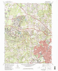
1982 Map of Vienna
USGS Topo · Published 1982About this map
The town of Vienna and the planned community of Reston anchor this suburban Virginia landscape during a period of rapid Northern Virginia development. The presence of the John Wesley Powell Federal Building (USGS National Center) marks the region's emergence as a federal hub, while the W & O D RR corridor, now a recreational trail, traces the path of the old Washington and Old Dominion Railroad. Cultural landmarks like Wolf Trap Farm Park For The Performing Arts and the Filene Center provide a sophisticated contrast to the traditional local history found at the Colvin Run Mill.
Find a feature on this map
155 named features on this map. Tap any name to fly to it.
Don’t see what you’re looking for? This feature index may not catch every label — zoom into the map to look around manually.
Map Details
Editions of this 1982 Vienna Map
This is the sole edition of this map. No revisions or reprints were ever made.
Other maps of this area

1890 · Mt. Vernon
USGS Topo · 1:125,000

1891 · Mt. Vernon
USGS Topo · 1:125,000

1893 · Frederick
USGS Topo · 1:125,000

1894 · Frederick
USGS Topo · 1:125,000

1894 · Mt. Vernon
USGS Topo · 1:125,000

1897 · Mt. Vernon
USGS Topo · 1:125,000

1900 · Washington
USGS Topo · 1:62,500

1908 · Rockville
USGS Topo · 1:62,500

1908 · Seneca
USGS Topo · 1:62,500

1915 · Fairfax
USGS Topo · 1:62,500