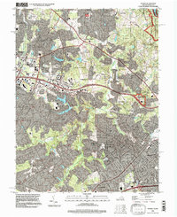
1994 Map of Vienna
USGS Topo · Published 1998About this map
Vienna and Reston define this landscape during a period of significant suburban integration and preservation in Northern Virginia. The map details the transition from rural crossroads like Dranesville and Vale to planned communities, centered around the W & OD Trail and the Dulles Airport Access Road. Waterways like Difficult Run and its numerous branches, including Snakeden Branch and The Glade, are buffered by extensive parklands such as Lake Fairfax County Park and the Wolf Trap Farm Park for the Performing Arts, featuring the Filene Center. Local history remains visible through sites like the Colvin Run Mill, Browns Chapel Cem, and several schoolhouses, showing how the 1990s footprint maintained links to its earlier agricultural and milling roots even as the John Wesley Powell Federal Building established a major institutional presence.
Find a feature on this map
79 named features on this map. Tap any name to fly to it.
Don’t see what you’re looking for? This feature index may not catch every label — zoom into the map to look around manually.
Map Details
Editions of this 1994 Vienna Map
This is the sole edition of this map. No revisions or reprints were ever made.
Other maps of this area

1890 · Mt. Vernon
USGS Topo · 1:125,000

1891 · Mt. Vernon
USGS Topo · 1:125,000

1893 · Frederick
USGS Topo · 1:125,000

1894 · Frederick
USGS Topo · 1:125,000

1894 · Mt. Vernon
USGS Topo · 1:125,000

1897 · Mt. Vernon
USGS Topo · 1:125,000

1900 · Washington
USGS Topo · 1:62,500

1908 · Rockville
USGS Topo · 1:62,500

1908 · Seneca
USGS Topo · 1:62,500

1915 · Fairfax
USGS Topo · 1:62,500