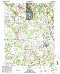
1996 Map of Vienna
USGS Topo · Published 1998About this map
Vienna serves as the hub of this Johnson County landscape, where the Shawnee National Forest occupies the northern and central highlands. The topography is defined by the winding course of the Cache River and its tributaries, including Dutchman Creek and Little Cache Creek. A distinct mix of agricultural flats and wooded bluffs, such as Wildcat Bluff to the south, characterizes the region.
Find a feature on this map
46 named features on this map. Tap any name to fly to it.
Don’t see what you’re looking for? This feature index may not catch every label — zoom into the map to look around manually.
Map Details
Editions of this 1996 Vienna Map
This is the sole edition of this map. No revisions or reprints were ever made.
Other maps of this area

1918 · Vienna
USGS Topo · 1:62,500

1919 · Vienna
USGS Topo · 1:62,500

1920 · Dongola
USGS Topo · 1:62,500

1922 · Carbondale
USGS Topo · 1:62,500

1923 · Dongola
USGS Topo · 1:62,500

1925 · Marion
USGS Topo · 1:62,500

1940 · Marion
USGS Topo · 1:62,500

1941 · Carbondale
USGS Topo · 1:62,500

1942 · Vienna
USGS Topo · 1:62,500

1949 · Paducah
USGS Topo · 1:250,000