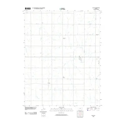
2009 Map of Vilas
USGS Topo · Published 2009About this map
The settlement of Vilas and the smaller community of Ridge anchor this agricultural landscape in Wilson County at the close of the first decade of the 21st century. The map reveals a highly structured rural grid defined by roads such as Alabama Rd and Arizona Rd, where the geometry of human settlement meets the meandering drainage of Village Creek and Woodruff Branch. Genealogists and local historians will find significant value in the distribution of three distinct burial grounds: the centrally located Village Creek Cemetery, the northerly Swede Center Cemetery, and the Vilas Bethel Cemetery situated near the main township. These landmarks, along with a network of secondary roads like Anderson Rd and Brown Rd, document the persistent layout of this Kansas farming district.
Find a feature on this map
18 named features on this map. Tap any name to fly to it.
Don’t see what you’re looking for? This feature index may not catch every label — zoom into the map to look around manually.
Map Details
Editions of this 2009 Vilas Map
This is the sole edition of this map. No revisions or reprints were ever made.
Other maps of this area

1886 · Fredonia
USGS Topo · 1:125,000

1886 · Iola
USGS Topo · 1:125,000

1893 · Iola
USGS Topo · 1:125,000

1894 · Fredonia
USGS Topo · 1:125,000

1904 · Iola
USGS Topo · 1:125,000

1938 · Altoona
USGS Topo · 1:62,500

1939 · Altoona
USGS Topo · 1:48,000

1943 · Altoona
USGS Topo · 1:62,500

1947 · Joplin
USGS Topo · 1:250,000

1949 · Joplin
USGS Topo · 1:250,000