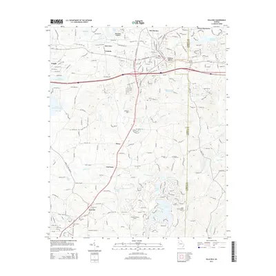
2014 Map of Villa Rica
USGS Topo · Published 2014About this map
Villa Rica serves as the focal point for this study of the borderlands between Carroll and Douglas counties. The landscape transitions from the developed corridors along Us-78 and Ga-8 to a more dispersed rural pattern defined by family-named landmarks and water bodies like the Little Tallapoosa River and Dog River. Local history is deeply embedded in the terrain, with numerous traditional burial grounds including the Old Villa Rica Cem and Macedonia Cem appearing alongside long-established communities such as Sand Hill, Ithaca, and Five Points. The topography is dominated by William Mtn, providing a stark contrast to the surrounding drainage basins of Crawfish Creek and Hominy Creek. Aviation history is also represented through smaller landing strips like the Diamond R Ranch Airport and Lucky Lairds Landing Airport, reflecting the region's mid-century developmental shift.
Find a feature on this map
49 named features on this map. Tap any name to fly to it.
Don’t see what you’re looking for? This feature index may not catch every label — zoom into the map to look around manually.
Map Details
Editions of this 2014 Villa Rica Map
This is the sole edition of this map. No revisions or reprints were ever made.
Other maps of this area

1889 · Tallapoosa
USGS Topo · 1:125,000

1891 · Marietta
USGS Topo · 1:125,000

1892 · Tallapoosa
USGS Topo · 1:125,000

1895 · Marietta
USGS Topo · 1:125,000

1897 · Marietta
USGS Topo · 1:125,000

1897 · Tallapoosa
USGS Topo · 1:125,000

1901 · Marietta
USGS Topo · 1:125,000

1953 · Atlanta
USGS Topo · 1:250,000

1957 · Atlanta
USGS Topo · 1:250,000

1958 · Rico
USGS Topo · 1:24,000