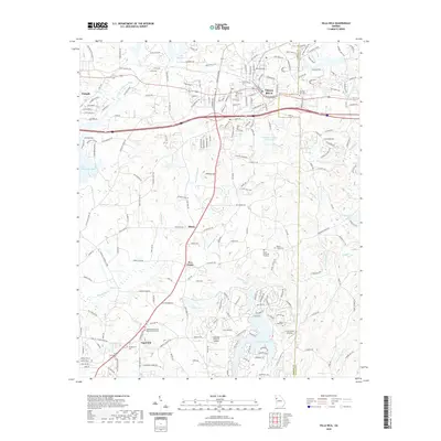
2020 Map of Villa Rica
USGS Topo · Published 2020About this map
The Carroll and Douglas County line bisects this portion of the Georgia Piedmont, centered on the growing industrial and residential corridors of Villa Rica. The landscape is a complex network of small watercourses like Bay Springs Creek and Crawfish Creek, feeding into larger reservoirs such as Villa Rica Water Works Lake and Hudson Lake. While modern infrastructure dominates the northern section near the interstate, the southern reaches maintain a more rural character defined by agricultural landmarks like the Diamond R Ranch Airport and small settlements including Ithaca and Five Points.
Find a feature on this map
213 named features on this map. Tap any name to fly to it.
Don’t see what you’re looking for? This feature index may not catch every label — zoom into the map to look around manually.
Map Details
Editions of this 2020 Villa Rica Map
This is the sole edition of this map. No revisions or reprints were ever made.
Other maps of this area

1889 · Tallapoosa
USGS Topo · 1:125,000

1891 · Marietta
USGS Topo · 1:125,000

1892 · Tallapoosa
USGS Topo · 1:125,000

1895 · Marietta
USGS Topo · 1:125,000

1897 · Marietta
USGS Topo · 1:125,000

1897 · Tallapoosa
USGS Topo · 1:125,000

1901 · Marietta
USGS Topo · 1:125,000

1953 · Atlanta
USGS Topo · 1:250,000

1957 · Atlanta
USGS Topo · 1:250,000

1958 · Rico
USGS Topo · 1:24,000