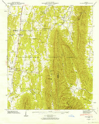
1946 Map of Villanow
USGS Topo · Published 1964About this map
Hurricane Valley and Mill Creek Valley dominate this mid-century portrait of northwestern Georgia, where the ridges of Rocky Face Mountain and Middle Mountain dictate the patterns of rural settlement. Small clusters of activity center around the village of Villanow and the community of Reo, while family-named landmarks like Cavender Cem, Puryear Cem, and Redwine Cove Cem provide specific points of interest for genealogists tracking local ancestry.
Find a feature on this map
60 named features on this map. Tap any name to fly to it.
Don’t see what you’re looking for? This feature index may not catch every label — zoom into the map to look around manually.
Map Details
Editions of this 1946 Villanow Map
3 editions found
Other maps of this area

1886 · Dalton
USGS Topo · 1:125,000

1886 · Ringgold
USGS Topo · 1:125,000

1892 · Ringgold
USGS Topo · 1:125,000

1892 · Dalton
USGS Topo · 1:125,000

1897 · Dalton
USGS Topo · 1:125,000

1935 · Catlett
USGS Topo · 1:24,000

1935 · Villanow
USGS Topo · 1:24,000

1935 · Nickajack Gap
USGS Topo · 1:24,000

1935 · Tunnel Hill
USGS Topo · 1:24,000

1938 · Chatsworth
USGS Topo · 1:48,000