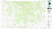
1983 Map of Villanueva
USGS Topo · Published 1984About this map
The Pecos River carves a deep valley through the high country of northern New Mexico, serving as a lifeline for small agricultural settlements like Villanueva and San Miguel. This landscape is defined by the sharp transition between the wooded heights of the Santa Fe National Forest and the expansive plateaus of Glorieta Mesa and Apache Mesa. The transportation history of the region is etched into the terrain, showing the path of the Atchison Topeka and Santa Fe railroad as it follows the drainage near Rowe, alongside major corridors like Interstate 25 and the legendary U S 66. To the south and east, the map captures the open ranching lands around Anton Chico and the lonely crossroads of Clines Corners, where high-desert travelers have long converged.
Find a feature on this map
43 named features on this map. Tap any name to fly to it.
Don’t see what you’re looking for? This feature index may not catch every label — zoom into the map to look around manually.
Map Details
Editions of this 1983 Villanueva Map
This is the sole edition of this map. No revisions or reprints were ever made.
Other maps of this area

1889 · Las Vegas
USGS Topo · 1:125,000

1889 · Santa Fe
USGS Topo · 1:125,000

1890 · Bernal
USGS Topo · 1:125,000

1891 · Bernal
USGS Topo · 1:125,000

1891 · Las Vegas
USGS Topo · 1:125,000

1892 · San Pedro
USGS Topo · 1:125,000

1892 · Santa Clara
USGS Topo · 1:125,000

1892 · Watrous
USGS Topo · 1:125,000

1892 · Corazon
USGS Topo · 1:125,000

1893 · Las Vegas
USGS Topo · 1:125,000