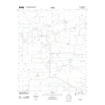
2011 Map of Vilonia
USGS Topo · Published 2011About this map
Vilonia and the surrounding Faulkner County countryside are defined by a complex network of waterways, with the North Fork Cypress Bayou, Middle Fork Cypress Bayou, and South Fork Cypress Bayou converging as they flow eastward. This 2011 survey captures the landscape just before significant modern expansion, highlighting established communities like Funston, Otto, and Center Point. The terrain is marked by numerous high points and crossings, including Carmichael Gap, Duncan Gap, and Snow Hill, which likely influenced the historical placement of roads and homesteads.
Find a feature on this map
145 named features on this map. Tap any name to fly to it.
Don’t see what you’re looking for? This feature index may not catch every label — zoom into the map to look around manually.
Map Details
Editions of this 2011 Vilonia Map
This is the sole edition of this map. No revisions or reprints were ever made.
Other maps of this area

1891 · Little Rock
USGS Topo · 1:125,000

1893 · Little Rock
USGS Topo · 1:125,000

1941 · Olmstead
USGS Topo · 1:31,680

1941 · Cabot
USGS Topo · 1:31,680

1953 · Cato
USGS Topo · 1:24,000

1954 · Olmstead
USGS Topo · 1:24,000
1954 · Cabot
USGS Topo · 1:24,000

1955 · Little Rock
USGS Topo · 1:250,000

1956 · Little Rock
USGS Topo · 1:250,000

1956 · Russellville
USGS Topo · 1:250,000