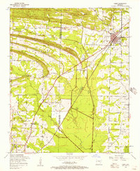
1954 Map of Cabot
USGS Topo · Published 1957About this map
Little Rock Air Force Base dominates the southwestern portion of this mid-century landscape, featuring a large Bomb Airfield and specialized facilities like a Power station near Jacksonville. The area transitions from the military installation and the rail-oriented town of Cabot into a rural network of family-named roads and community landmarks. The Missouri Pacific railroad cuts a diagonal line through the terrain, connecting small settlements like Toneyville and Holland.
Find a feature on this map
44 named features on this map. Tap any name to fly to it.
Don’t see what you’re looking for? This feature index may not catch every label — zoom into the map to look around manually.
Map Details
Editions of this 1954 Cabot Map
3 editions found
Other maps of this area

1891 · Little Rock
USGS Topo · 1:125,000

1893 · Little Rock
USGS Topo · 1:125,000

1935 · Mc Almont
USGS Topo · 1:24,000

1940 · Lonoke
USGS Topo · 1:62,500

1941 · Olmstead
USGS Topo · 1:31,680

1941 · Cabot
USGS Topo · 1:31,680

1943 · Jacksonville
USGS Topo · 1:31,680

1948 · Helena
USGS Topo · 1:250,000

1949 · Lonoke
USGS Topo · 1:62,500

1950 · Helena
USGS Topo · 1:250,000