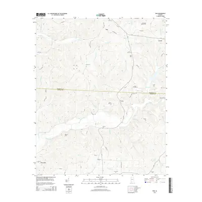
2014 Map of Vina
USGS Topo · Published 2014About this map
The Tennessee Valley Divide cuts across this northern Alabama landscape, marking the transition between the drainage basins of the Tennessee River and the Tombigbee River. This 2014 survey captures the rural character of the area where the Franklin Co and Marion Co line meets. Local family history is preserved in a dense network of small burial grounds including the Childers Family Cem, Brazel Cem, and Nichols Cem, suggesting generations of deep-rooted settlement.
Find a feature on this map
87 named features on this map. Tap any name to fly to it.
Don’t see what you’re looking for? This feature index may not catch every label — zoom into the map to look around manually.
Map Details
Editions of this 2014 Vina Map
This is the sole edition of this map. No revisions or reprints were ever made.
Other maps of this area

1936 · Hodges
USGS Topo · 1:24,000

1936 · Red Bay
USGS Topo · 1:24,000

1936 · Vina
USGS Topo · 1:24,000

1936 · Halltown
USGS Topo · 1:24,000

1936 · Guinn Cross Roads
USGS Topo · 1:24,000
1946 · Guinn Cross Roads
USGS Topo · 1:24,000
1947 · Guinn Cross Roads
USGS Topo · 1:24,000

1949 · Hodges
USGS Topo · 1:24,000

1950 · Vina
USGS Topo · 1:24,000
1950 · Halltown
USGS Topo · 1:24,000