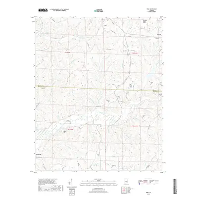
2018 Map of Vina
USGS Topo · Published 2018About this map
Vina serves as the focal point of this Northwest Alabama landscape, situated just south of the Tennessee Valley Divide. The terrain is defined by a dense network of tributaries including Hurricane Cr, Mill Br, and Bull Mountain Cr, which carve through the hills near Buzzard Bluff and Pilot Hill. The mapping of these watercourses, such as Mule Stable Br and Skirum Cr, reveals a highly dissected topography where settlements like Atwood and Shottsville are connected by narrow county roads following ridgelines and valley floors.
Find a feature on this map
97 named features on this map. Tap any name to fly to it.
Don’t see what you’re looking for? This feature index may not catch every label — zoom into the map to look around manually.
Map Details
Editions of this 2018 Vina Map
This is the sole edition of this map. No revisions or reprints were ever made.
Other maps of this area

1936 · Hodges
USGS Topo · 1:24,000

1936 · Red Bay
USGS Topo · 1:24,000

1936 · Vina
USGS Topo · 1:24,000

1936 · Halltown
USGS Topo · 1:24,000

1936 · Guinn Cross Roads
USGS Topo · 1:24,000
1946 · Guinn Cross Roads
USGS Topo · 1:24,000
1947 · Guinn Cross Roads
USGS Topo · 1:24,000

1949 · Hodges
USGS Topo · 1:24,000

1950 · Vina
USGS Topo · 1:24,000
1950 · Halltown
USGS Topo · 1:24,000