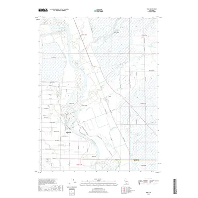
2018 Map of Vina
USGS Topo · Published 2018About this map
The Sacramento River dominates this portion of Tehama County, its winding course defined by riverine features like Blethen Island, Copeland Bar, and the turbulent Captain Jones Rapids. The settlement of Vina sits east of the river, surrounded by a complex network of irrigation and drainage channels including the W N Main Canal, Vina Slough, and the Hoag Slough. To the south, the Tehama and Butte county line crosses near Hazel Bend and Moone Bar.
Find a feature on this map
54 named features on this map. Tap any name to fly to it.
Don’t see what you’re looking for? This feature index may not catch every label — zoom into the map to look around manually.
Map Details
Editions of this 2018 Vina Map
This is the sole edition of this map. No revisions or reprints were ever made.
Other maps of this area

1886 · Lassen Peak
USGS Topo · 1:250,000

1890 · Red Bluff
USGS Topo · 1:250,000

1891 · Chico
USGS Topo · 1:125,000

1892 · Lassen Peak
USGS Topo · 1:250,000

1893 · Chico
USGS Topo · 1:125,000

1894 · Lassen Peak
USGS Topo · 1:250,000

1894 · Red Bluff
USGS Topo · 1:250,000

1895 · Chico
USGS Topo · 1:125,000

1904 · Vina
USGS Topo · 1:62,500

1905 · Tehama
USGS Topo · 1:62,500