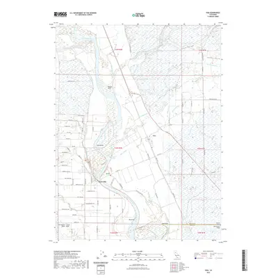
2022 Map of Vina
USGS Topo · Published 2022About this map
Vina sits at the heart of this agricultural and riparian landscape, where the Sacramento River carves a winding path through the northern Central Valley. The river's influence is evident in the complex network of side channels and landforms, including Kopta Slough, Champlin Slough, and Vina Slough. Notable river features such as Blethen Island, Copeland Bar, and the Captain Jones Rapids illustrate the dynamic nature of this waterway.
Find a feature on this map
82 named features on this map. Tap any name to fly to it.
Don’t see what you’re looking for? This feature index may not catch every label — zoom into the map to look around manually.
Map Details
Editions of this 2022 Vina Map
This is the sole edition of this map. No revisions or reprints were ever made.
Other maps of this area

1886 · Lassen Peak
USGS Topo · 1:250,000

1890 · Red Bluff
USGS Topo · 1:250,000

1891 · Chico
USGS Topo · 1:125,000

1892 · Lassen Peak
USGS Topo · 1:250,000

1893 · Chico
USGS Topo · 1:125,000

1894 · Lassen Peak
USGS Topo · 1:250,000

1894 · Red Bluff
USGS Topo · 1:250,000

1895 · Chico
USGS Topo · 1:125,000

1904 · Vina
USGS Topo · 1:62,500

1905 · Tehama
USGS Topo · 1:62,500