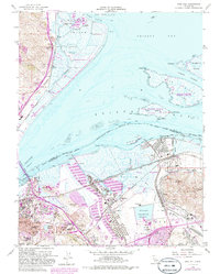
2021 Map of Vine Hill
USGS Topo · Published 2021About this map
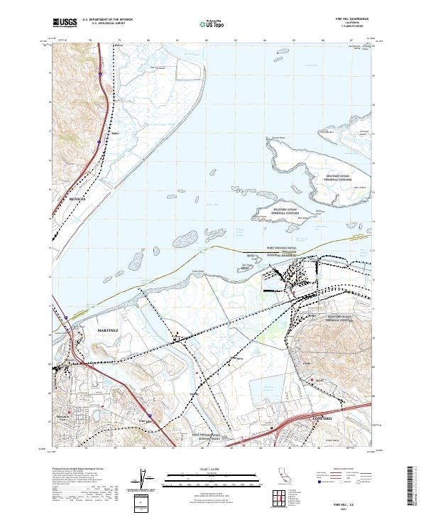
The industrial and military shoreline of Suisun Bay defines this landscape where Contra Costa and Solano counties meet. The complex infrastructure of the Military Ocean Terminal Concord and the Port Chicago Naval Magazine National Memorial dominate the waterfront, reflecting the region's long-standing strategic importance. Inland, the map details the residential and industrial growth of Martinez and Concord, alongside smaller communities like Vine Hill and Clyde. Significant water management systems, including the Mokelumne Aqueduct and Contra Costa Canal, navigate the space between the marshes of Morrow Island and the rising slopes of the Diablo Range. This survey documents a critical junction of maritime navigation, fuel logistics at the Ozol Defense Fuel Support Point, and suburban expansion near the Mallard Reservoir and Memory Gardens Cem.
Find a feature on this map
129 named features on this map. Tap any name to fly to it.
Don’t see what you’re looking for? This feature index may not catch every label — zoom into the map to look around manually.
Map Details
Editions of this 2021 Vine Hill Map
This is the sole edition of this map. No revisions or reprints were ever made.
Historical Maps of Concord Through Time
5 maps found