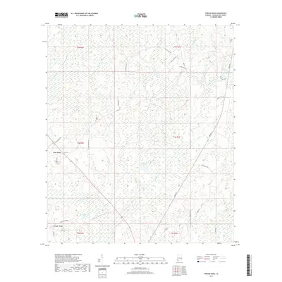
2018 Map of Vinegar Bend
USGS Topo · Published 2018About this map
The Escatawpa River winds through the southwestern corner of this Washington County landscape, anchoring a terrain defined by extensive wetlands and creek systems. Small settlements and rural road networks, such as Vinegar Bend and Four Point, mark the human imprint on this coastal plain environment. The presence of Four Points Cem and Tibbie Cem offers localized points of interest for genealogical research, while family-named features like Parnells Pond and D R Stallworth Pond suggest deep-rooted land ownership patterns. The map detail reflects a quiet, low-lying region where water dominates the geography, from the meandering Creeping Swamp Cr to the larger Stallworth Lake.
Find a feature on this map
42 named features on this map. Tap any name to fly to it.
Don’t see what you’re looking for? This feature index may not catch every label — zoom into the map to look around manually.
Map Details
Editions of this 2018 Vinegar Bend Map
This is the sole edition of this map. No revisions or reprints were ever made.
Other maps of this area

1942 · Deer Park
USGS Topo · 1:62,500

1943 · Deer Park
USGS Topo · 1:62,500

1943 · Citronelle
USGS Topo · 1:62,500

1943 · McIntosh
USGS Topo · 1:62,500

1944 · McIntosh
USGS Topo · 1:62,500

1946 · Citronelle
USGS Topo · 1:62,500

1953 · Hattiesburg
USGS Topo · 1:250,000

1958 · Hattiesburg
USGS Topo · 1:250,000

1974 · Fruitdale
USGS Topo · 1:24,000

1974 · Chatom
USGS Topo · 1:24,000