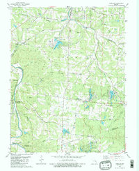
1981 Map of Vineland
USGS Topo · Published 1982About this map
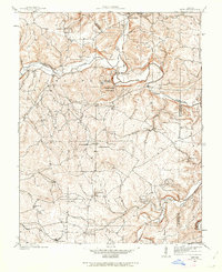
Valles Mines and the surrounding mineral-rich borderlands of Jefferson and St. Francois counties are captured here in the early 1980s. This survey illustrates a landscape defined by its mining heritage and its transition toward recreational development, with numerous artificial water bodies like Summerset Lake, Valle Lake, and Lake Timberline dotting the hills. The Missouri Pacific Railroad follows the winding course of the Big River, passing through small settlements like Blackwell and Vineland. Local history is preserved through a dense network of family and community landmarks, including the Moontown and Old Blackwell cemeteries, and the Sunrise School. The presence of Dripping Springs Hollow and the Big River State Forest highlights the interplay between the area's industrial past and its rugged natural terrain.
Find a feature on this map
57 named features on this map. Tap any name to fly to it.
Don’t see what you’re looking for? This feature index may not catch every label — zoom into the map to look around manually.
Map Details
Editions of this 1981 Vineland Map
2 editions found
Other maps of this area

1901 · De Soto
USGS Topo · 1:125,000

1904 · Farmington
USGS Topo · 1:62,500

1905 · Bonneterre
USGS Topo · 1:62,500

1906 · Farmington
USGS Topo · 1:62,500

1915 · Crystal City
USGS Topo · 1:62,500

1930 · De Soto NE
USGS Topo · 1:24,000
1931 · De Soto SE
USGS Topo · 1:24,000
1937 · Fletcher
USGS Topo · 1:24,000
1937 · Tiff
USGS Topo · 1:24,000

1938 · Fletcher
USGS Topo · 1:24,000