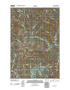
2011 Map of Vinemaple
USGS Topo · Published 2011About this map
Jewell and the Nehalem Valley define this landscape in the Oregon Coast Range, where the winding Nehalem River meets a network of timber-access roads and creek drainages. The map details the transition from the river bottom near Vinemaple up into the high ridges, including Boiler Ridge and Red Bluff Ridge. This era shows a landscape heavily shaped by the logging industry, evidenced by the extensive network of forest routes like the Fish Hawk Mainline and Saraj Arvie Ridge Rd that crisscross the timberlands between Fishhawk Creek and Beneke Creek. Local history is anchored by landmarks such as the Jewell Cemetery and the Vinemaple Bridge, while the confluence of several large creeks near Tideport and Grand Rapids illustrates the drainage patterns essential to the region's geography. Natural features like Fishhawk Falls and the high point at Tidewater Summit provide distinct navigational markers among the steep terrain.
Find a feature on this map
48 named features on this map. Tap any name to fly to it.
Don’t see what you’re looking for? This feature index may not catch every label — zoom into the map to look around manually.
Map Details
Editions of this 2011 Vinemaple Map
This is the sole edition of this map. No revisions or reprints were ever made.
Other maps of this area

1939 · Saddle Mountain
USGS Topo · 1:62,500

1940 · Svensen
USGS Topo · 1:62,500

1941 · Keasey
USGS Topo · 1:62,500

1941 · Cathlamet
USGS Topo · 1:62,500

1943 · Keasey
USGS Topo · 1:62,500

1943 · Saddle Mtn.
USGS Topo · 1:62,500

1948 · Vancouver
USGS Topo · 1:250,000

1949 · Green Mountain
USGS Topo · 1:24,000

1950 · Vancouver
USGS Topo · 1:250,000

1950 · Vancouver
USGS Topo · 1:250,000