
1949 Map of Green Mountain
USGS Topo · Published 1955About this map
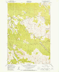
The Klaskanine Fish Hatchery stands as a central landmark in this 1940s landscape, situated where the North Fork Klaskanine River and South Fork Klaskanine River converge. The area’s industrial character is defined by an extensive network of timber-related infrastructure, including the Nehalem North Fork Klaskanine RR and several repurposed pathways such as Glazers Grade and the Nehalem Barrel Grade. These transportation routes, along with various abandoned logging roads, trace the history of the timber industry as it moved through the drainages of Green Mountain and toward the Youngs River. Small localized settlements like Lilleas and Estoos provide evidence of rural habitation near the river forks, while Barth Falls marks a prominent natural feature along the water's course. The map documents a period when former rail grades were transitioning into the road systems that supported mid-century forest management and local commerce.
Find a feature on this map
22 named features on this map. Tap any name to fly to it.
Don’t see what you’re looking for? This feature index may not catch every label — zoom into the map to look around manually.
Map Details
Editions of this 1949 Green Mountain Map
2 editions found
Other maps of this area

1919 · Astoria
USGS Topo · 1:62,500

1939 · Astoria
USGS Topo · 1:62,500

1939 · Saddle Mountain
USGS Topo · 1:62,500

1940 · Svensen
USGS Topo · 1:62,500

1940 · Cape Falcon
USGS Topo · 1:62,500

1943 · Saddle Mtn.
USGS Topo · 1:62,500

1948 · Vancouver
USGS Topo · 1:250,000

1949 · Astoria
USGS Topo · 1:24,000

1949 · Cathlamet Bay
USGS Topo · 1:24,000
1949 · Olney
USGS Topo · 1:24,000