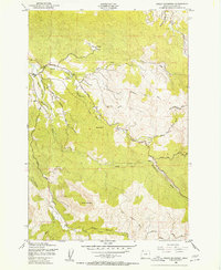
1949 Map of Green Mountain
USGS Topo · Published 1955About this map
The North Fork Klaskanine River and its various tributaries define the drainage patterns of this coastal Oregon landscape as it appeared in the late 1940s. The map illustrates a shift from industrial exploitation to conservation, showing an Old Railroad Grade and several instances of an Abandoned Logging Road crisscrossing the terrain near Green Mountain.
Find a feature on this map
25 named features on this map. Tap any name to fly to it.
Don’t see what you’re looking for? This feature index may not catch every label — zoom into the map to look around manually.
Map Details
Editions of this 1949 Green Mountain Map
2 editions found
Other maps of this area

1919 · Astoria
USGS Topo · 1:62,500

1939 · Astoria
USGS Topo · 1:62,500

1939 · Saddle Mountain
USGS Topo · 1:62,500

1940 · Svensen
USGS Topo · 1:62,500

1940 · Cape Falcon
USGS Topo · 1:62,500

1943 · Saddle Mtn.
USGS Topo · 1:62,500

1948 · Vancouver
USGS Topo · 1:250,000

1949 · Astoria
USGS Topo · 1:24,000

1949 · Cathlamet Bay
USGS Topo · 1:24,000

1949 · Green Mountain
USGS Topo · 1:24,000