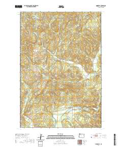
2020 Map of Vinemaple
USGS Topo · Published 2020About this map
The Nehalem River meanders through the southern portion of this region, providing a focal point for the small settlements of Vinemaple and Jewell. This 2020 layout shows a landscape defined by its complex drainage systems and significant ridges, where numerous waterways like Fishhawk Cr and Little Fishhawk Cr carve through the coastal range terrain. The area is marked by prominent high points such as Tidewater Summit and Denver Point, which overlook a network of logging and rural roads.
Find a feature on this map
58 named features on this map. Tap any name to fly to it.
Don’t see what you’re looking for? This feature index may not catch every label — zoom into the map to look around manually.
Map Details
Editions of this 2020 Vinemaple Map
This is the sole edition of this map. No revisions or reprints were ever made.
Other maps of this area

1939 · Saddle Mountain
USGS Topo · 1:62,500

1940 · Svensen
USGS Topo · 1:62,500

1941 · Keasey
USGS Topo · 1:62,500

1941 · Cathlamet
USGS Topo · 1:62,500

1943 · Keasey
USGS Topo · 1:62,500

1943 · Saddle Mtn.
USGS Topo · 1:62,500

1948 · Vancouver
USGS Topo · 1:250,000

1949 · Green Mountain
USGS Topo · 1:24,000

1950 · Vancouver
USGS Topo · 1:250,000

1950 · Vancouver
USGS Topo · 1:250,000