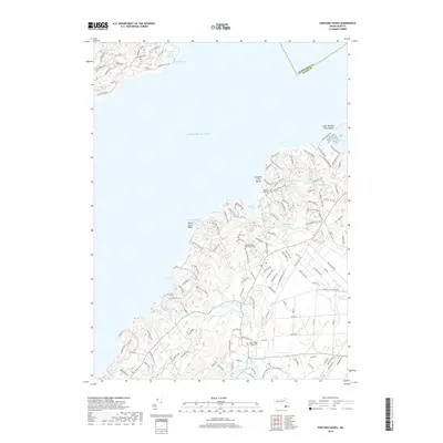
2018 Map of Vineyard Haven
USGS Topo · Published 2018About this map
The northern coastline of Martha's Vineyard is defined here by protected coastal ponds and tidal inlets that separate the shoreline from the interior hills. Lake Tashmoo and James Pond sit at the edge of the Atlantic Ocean, while the interior landscape is marked by glacial kettle ponds like Seths Pond and Duarte Ponds. The presence of several historic burial grounds, including the West Tisbury Village Cem and the Christiantown Memorial Cem, points to the long-standing settlement of the area. This 2018 survey reveals a network of ancient ways and modern roads such as Lamberts Cove Rd and Christiantown Rd that connect the coastal beaches at North Shore Beach and Lamberts Cove Beach to the interior wetlands of Great Swamp and the waterways of Mill Brook and Paint Mill Brook.
Find a feature on this map
149 named features on this map. Tap any name to fly to it.
Don’t see what you’re looking for? This feature index may not catch every label — zoom into the map to look around manually.
Map Details
Editions of this 2018 Vineyard Haven Map
This is the sole edition of this map. No revisions or reprints were ever made.
Other maps of this area

1885 · New Bedford
USGS Topo · 1:62,500

1886 · Falmouth
USGS Topo · 1:62,500

1887 · Gay Head
USGS Topo · 1:62,500

1887 · Marthas Vineyard
USGS Topo · 1:62,500

1888 · New Bedford
USGS Topo · 1:62,500

1888 · Falmouth
USGS Topo · 1:62,500

1889 · Gay Head
USGS Topo · 1:62,500

1889 · Marthas Vineyard
USGS Topo · 1:62,500

1893 · Gay Head
USGS Topo · 1:62,500

1893 · Falmouth
USGS Topo · 1:62,500