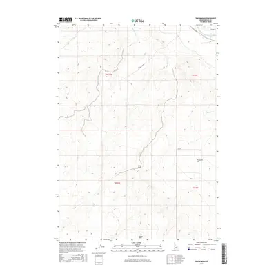
2017 Map of Vinson Wash
USGS Topo · Published 2017About this map
Vinson Wash and Poison Gulch define the drainage patterns of this arid landscape in Owyhee County, where the terrain transitions from the high-desert drainages to the artificial water systems of the Snake River valley. The presence of the Grand View Irrigation District Canal along the northeastern edge illustrates the critical role of water management in supporting the region's agricultural viability. While much of the area consists of open terrain like Twentymile Flat, the local road network—including Mud Flat Rd and the curiously named Missile Base Rd—provides evidence of both ranching access and Cold War-era infrastructure. Researchers can also trace seasonal watercourses such as Birch Cr, McKeeth Wash, and Jensen Wash, which carve distinct topographical features through the surrounding ridges and plateaus.
Find a feature on this map
15 named features on this map. Tap any name to fly to it.
Don’t see what you’re looking for? This feature index may not catch every label — zoom into the map to look around manually.
Map Details
Editions of this 2017 Vinson Wash Map
This is the sole edition of this map. No revisions or reprints were ever made.
Other maps of this area

1892 · Bisuka
USGS Topo · 1:125,000

1894 · Bisuka
USGS Topo · 1:125,000

1947 · Grand View
USGS Topo · 1:62,500

1947 · Grand View
USGS Topo · 1:24,000

1947 · Jackass Butte
USGS Topo · 1:24,000

1947 · Chalk Hills
USGS Topo · 1:24,000

1947 · Vinson Wash
USGS Topo · 1:24,000

1947 · Perjue Canyon
USGS Topo · 1:24,000

1947 · Dorsey Butte
USGS Topo · 1:24,000

1948 · Castle Butte
USGS Topo · 1:24,000