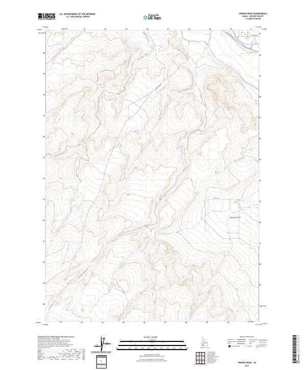
2023 Map of Vinson Wash
USGS Topo · Published 2023About this map
The Grand View Irrigation District Canal cuts through the northeast corner of this arid Idaho landscape, serving as a vital artery for agricultural development in an otherwise high-desert drainage system. The terrain is defined by a series of deep cuts and seasonal waterways, including McKeeth Wash, Jensen Wash, and the aptly named Poison Gulch to the south. These features reveal the complex hydrology required to sustain life and ranching in Owyhee County, where the topography transitions into the broad expanse of Twentymile Flat. Modern infrastructure intersects with the traditional landscape along Missile Base Rd and Mud Flat Rd, illustrating the region's utility for both transport and strategic land use. Local history researchers can trace the path of Birch Creek as it meanders through the township boundaries of T5S and T6S, marking the subtle shifts in elevation across this part of the Snake River Plain hinterlands.
Find a feature on this map
14 named features on this map. Tap any name to fly to it.
Don’t see what you’re looking for? This feature index may not catch every label — zoom into the map to look around manually.
Map Details
Editions of this 2023 Vinson Wash Map
This is the sole edition of this map. No revisions or reprints were ever made.
Other maps of this area

1892 · Bisuka
USGS Topo · 1:125,000

1894 · Bisuka
USGS Topo · 1:125,000

1947 · Grand View
USGS Topo · 1:62,500

1947 · Grand View
USGS Topo · 1:24,000

1947 · Jackass Butte
USGS Topo · 1:24,000

1947 · Chalk Hills
USGS Topo · 1:24,000

1947 · Vinson Wash
USGS Topo · 1:24,000

1947 · Perjue Canyon
USGS Topo · 1:24,000

1947 · Dorsey Butte
USGS Topo · 1:24,000

1948 · Castle Butte
USGS Topo · 1:24,000