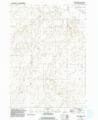
1992 Map of Vinson Wash
USGS Topo · Published 1992About this map
The arid Owyhee County landscape takes center stage in this 1992 revision, which traces a network of drainage channels including Vinson Wash and McKeeth Wash as they descend toward the Snake River valley. The infrastructure of high-desert agriculture is clearly defined in the northeast, where the Grand View Mutual Irrigation District Canal cuts across the terrain. A notable engineering detail is the Siphon located near the boundary of the irrigation district, illustrating the complex water management required to support the region.
Find a feature on this map
17 named features on this map. Tap any name to fly to it.
Don’t see what you’re looking for? This feature index may not catch every label — zoom into the map to look around manually.
Map Details
Editions of this 1992 Vinson Wash Map
This is the sole edition of this map. No revisions or reprints were ever made.
Other maps of this area

1892 · Bisuka
USGS Topo · 1:125,000

1894 · Bisuka
USGS Topo · 1:125,000

1947 · Grand View
USGS Topo · 1:62,500

1947 · Grand View
USGS Topo · 1:24,000

1947 · Jackass Butte
USGS Topo · 1:24,000

1947 · Chalk Hills
USGS Topo · 1:24,000

1947 · Vinson Wash
USGS Topo · 1:24,000

1947 · Perjue Canyon
USGS Topo · 1:24,000

1947 · Dorsey Butte
USGS Topo · 1:24,000

1948 · Castle Butte
USGS Topo · 1:24,000