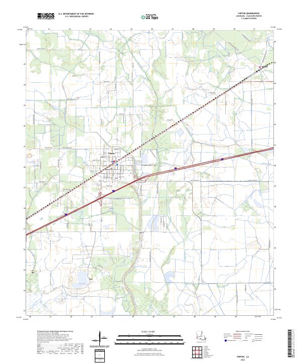
2024 Map of Vinton
USGS Topo · Published 2024About this map
Vinton serves as the primary hub in this Calcasieu Parish landscape, characterized by a complex network of man-made waterways and natural drainages that define the local geography. The town is situated at a critical junction of transit and water management, where the Sabine Canal and Vinton Drainage Canal interface with the surrounding wetlands. Further east, the settlement of Edgerly marks the edge of this prairie-and-marsh terrain, while to the south, Ged sits near the shores of Ged Lake. The mapping reveals a distinct grid of rural roads and coulees, such as Hampton Coulee and Coon Gully, which illustrate how the land has been subdivided and drained for agricultural or industrial use. This modern topographic survey by the U.S. Geological Survey provides a detailed look at the contemporary infrastructure and water control systems that sustain these communities in southwest Louisiana.
Find a feature on this map
73 named features on this map. Tap any name to fly to it.
Don’t see what you’re looking for? This feature index may not catch every label — zoom into the map to look around manually.
Map Details
Editions of this 2024 Vinton Map
This is the sole edition of this map. No revisions or reprints were ever made.
Other maps of this area

1932 · Orange
USGS Topo · 1:62,500

1946 · Phoenix Lake
USGS Topo · 1:31,680

1947 · Sulphur
USGS Topo · 1:31,680

1947 · Starks
USGS Topo · 1:31,680

1947 · Vinton
USGS Topo · 1:31,680

1947 · Toomey
USGS Topo · 1:31,680

1947 · Sulphur Mines
USGS Topo · 1:31,680

1947 · Lunita
USGS Topo · 1:31,680
1949 · Cameron Farms
USGS Topo · 1:31,680
1949 · Black Lake
USGS Topo · 1:31,680