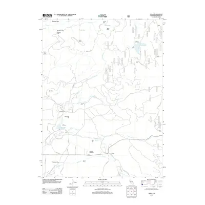
2012 Map of Viola
USGS Topo · Published 2012About this map
Viola serves as a central point in this part of Shasta County, situated where Bailey Cr flows through Scharsch Meadows. The landscape is defined by the complex water systems of the North Fork Battle Creek watershed, featuring significant impoundments at North Battle Creek Reservoir and McCumber Reservoir. The presence of Camp McCumber and Reservoir Public Camp suggests the area's established role as a destination for outdoor recreation and youth camps. Historical land use is evident through numerous named family homesteads and agricultural operations, such as Scharsch Ranch, Nunes Ranch, and Armstrong Ranch. Higher elevations are marked by distinctive geological features including Mushroom Rock, Rooster Comb, and Palisade Cliff, while transportation is facilitated by a network of forest routes and the historic Emigrant Trl, which snakes across the lower terrain near Eastman Place.
Find a feature on this map
95 named features on this map. Tap any name to fly to it.
Don’t see what you’re looking for? This feature index may not catch every label — zoom into the map to look around manually.
Map Details
Editions of this 2012 Viola Map
This is the sole edition of this map. No revisions or reprints were ever made.
Other maps of this area

1886 · Lassen Peak
USGS Topo · 1:250,000

1892 · Lassen Peak
USGS Topo · 1:250,000

1894 · Lassen Peak
USGS Topo · 1:250,000

1935 · Burney
USGS Topo · 1:96,000

1935 · Paynes Creek
USGS Topo · 1:96,000

1939 · Burney
USGS Topo · 1:125,000

1941 · Mineral
USGS Topo · 1:125,000

1955 · Westwood
USGS Topo · 1:250,000

1956 · Lassen Peak
USGS Topo · 1:62,500

1956 · Manton
USGS Topo · 1:62,500