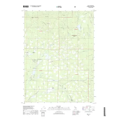
2018 Map of Viola
USGS Topo · Published 2018About this map
The settlement of Viola serves as the central hub of this Shasta County landscape, situated where the high-altitude meadows meet the timbered slopes of the Lassen National Forest. This 2018 survey reveals a terrain defined by clearings like Dersch Meadows, Scharsch Meadows, and Bailey Creek Meadows, connected by a network of forest roads such as Thatcher Mill Rd and Ritts Mill Rd. The map illustrates the headwaters of numerous drainages including N Fork Battle Cr and Beal Cr, while also capturing the distinct geological formations of Palisade Cliff, Mushroom Rock, and the Rooster Comb. To the north, the elevation rises toward Latour Butte and Buck Butte, showing the interface between the high volcanic plateaus and the springs like Mountain Home Spring that support the region's scattered forest-based homesteads and cattle ranges.
Find a feature on this map
58 named features on this map. Tap any name to fly to it.
Don’t see what you’re looking for? This feature index may not catch every label — zoom into the map to look around manually.
Map Details
Editions of this 2018 Viola Map
This is the sole edition of this map. No revisions or reprints were ever made.
Other maps of this area

1886 · Lassen Peak
USGS Topo · 1:250,000

1892 · Lassen Peak
USGS Topo · 1:250,000

1894 · Lassen Peak
USGS Topo · 1:250,000

1935 · Burney
USGS Topo · 1:96,000

1935 · Paynes Creek
USGS Topo · 1:96,000

1939 · Burney
USGS Topo · 1:125,000

1941 · Mineral
USGS Topo · 1:125,000

1955 · Westwood
USGS Topo · 1:250,000

1956 · Lassen Peak
USGS Topo · 1:62,500

1956 · Manton
USGS Topo · 1:62,500