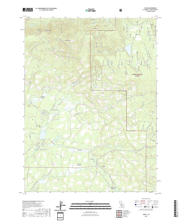
2021 Map of Viola
USGS Topo · Published 2021About this map
Lassen National Forest defines the eastern landscape of this Shasta County region, where the high-altitude terrain is marked by distinctive formations like Castle Rock, Buck Butte, and the Rooster Comb. The settlement of Viola sits along Ca 44 near the southern map boundary, serving as a gateway to a network of meadowlands including Scharsch Meadows and Deer Flat. This area preserves evidence of early mountain industry and transit, with Ritts Mill Rd and Thatcher Mill Rd tracing old timber or milling routes near Thatchers Meadows. The historic Nobles Trl cuts across the southeast, following the natural corridors carved by Manzanita Cr and Bailey Cr. Above the meadows, the landscape rises sharply toward Latour Butte, where Latour Butte Lookout Rd provides access to the high northern ridges overlooking S Cow Cr.
Find a feature on this map
57 named features on this map. Tap any name to fly to it.
Don’t see what you’re looking for? This feature index may not catch every label — zoom into the map to look around manually.
Map Details
Editions of this 2021 Viola Map
This is the sole edition of this map. No revisions or reprints were ever made.
Other maps of this area

1886 · Lassen Peak
USGS Topo · 1:250,000

1892 · Lassen Peak
USGS Topo · 1:250,000

1894 · Lassen Peak
USGS Topo · 1:250,000

1935 · Burney
USGS Topo · 1:96,000

1935 · Paynes Creek
USGS Topo · 1:96,000

1939 · Burney
USGS Topo · 1:125,000

1941 · Mineral
USGS Topo · 1:125,000

1955 · Westwood
USGS Topo · 1:250,000

1956 · Lassen Peak
USGS Topo · 1:62,500

1956 · Manton
USGS Topo · 1:62,500