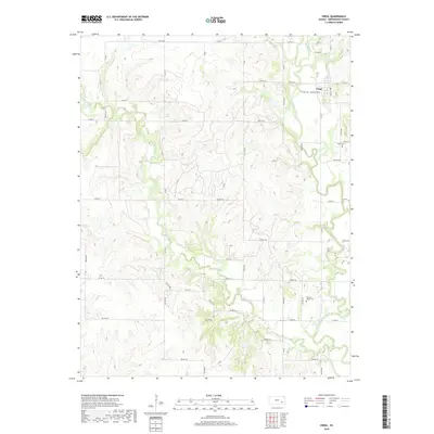
2018 Map of Virgil
USGS Topo · Published 2018About this map
The Verdigris River snakes through this portion of Greenwood County, defining a landscape of riparian corridors and agricultural sections. The small settlement of Virgil serves as the primary hub, where local life centers on the intersection of Virgil Rd, Washington St, and Main St. Genealogists and historians will find significant value in the detailed plotting of Virgil Cem and Pleasant Valley Cem, providing exact locations for these ancestral resting places. The surrounding terrain is drained by several watercourses, including Greenhall Cr, West Creek, and Willow Creek, which feed into the river system. A grid of rural township roads, such as Twp Rd 274 and Twp Rd 242A, links the outlying farms to the town center, illustrating the enduring spatial patterns of Kansas prairie settlement.
Find a feature on this map
62 named features on this map. Tap any name to fly to it.
Don’t see what you’re looking for? This feature index may not catch every label — zoom into the map to look around manually.
Map Details
Editions of this 2018 Virgil Map
This is the sole edition of this map. No revisions or reprints were ever made.
Other maps of this area

1885 · Burlington
USGS Topo · 1:125,000

1885 · Eureka
USGS Topo · 1:125,000

1886 · Fredonia
USGS Topo · 1:125,000

1888 · Emporia
USGS Topo · 1:125,000

1888 · Eureka
USGS Topo · 1:125,000

1894 · Emporia
USGS Topo · 1:125,000

1894 · Fredonia
USGS Topo · 1:125,000

1894 · Burlington
USGS Topo · 1:125,000

1894 · Eureka
USGS Topo · 1:125,000

1947 · Lawrence
USGS Topo · 1:250,000