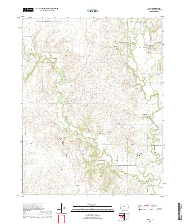
2022 Map of Virgil
USGS Topo · Published 2022About this map
Virgil occupies the northeastern corner of this Greenwood County landscape, where Main St and Washington St anchor the local grid just south of the Verdigris River. The surrounding terrain is defined by a dense network of watercourses, including West Creek and Willow Creek, which carve through the rural sections. These creek valleys dictate the placement of the township roads, creating a patchwork of sections that reveal the long-standing agricultural and ranching patterns of eastern Kansas. Genealogists and local historians will find significant landmarks at the Virgil Cem southeast of town and the more isolated Pleasant Valley Cem further south. The map documents the persistent rural character of the region, showing how contemporary infrastructure like Virgil Rd and Co Rd 4 follows the historical land divisions established in the 19th century.
Find a feature on this map
67 named features on this map. Tap any name to fly to it.
Don’t see what you’re looking for? This feature index may not catch every label — zoom into the map to look around manually.
Map Details
Editions of this 2022 Virgil Map
This is the sole edition of this map. No revisions or reprints were ever made.
Other maps of this area

1885 · Burlington
USGS Topo · 1:125,000

1885 · Eureka
USGS Topo · 1:125,000

1886 · Fredonia
USGS Topo · 1:125,000

1888 · Emporia
USGS Topo · 1:125,000

1888 · Eureka
USGS Topo · 1:125,000

1894 · Emporia
USGS Topo · 1:125,000

1894 · Fredonia
USGS Topo · 1:125,000

1894 · Burlington
USGS Topo · 1:125,000

1894 · Eureka
USGS Topo · 1:125,000

1947 · Lawrence
USGS Topo · 1:250,000