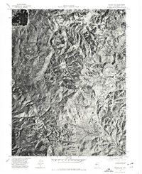
1974 Map of Virginia City
USGS Topo · Published 1977About this map
Virginia City occupies the eastern slopes of the high desert terrain on this mid-1970s orthophotoquad, showing the historic mining hub and its surrounding environment from an aerial perspective. This specific format uses photographic imagery rather than traditional line work, capturing the density of the settlement alongside the distinct geological scarring of the landscape. The steep drainages of the Virginia Range dominate the center of the sheet, where narrow ravines and high ridges define the difficult geography of the Comstock region.
Find a feature on this map
5 named features on this map. Tap any name to fly to it.
Don’t see what you’re looking for? This feature index may not catch every label — zoom into the map to look around manually.
Map Details
Editions of this 1974 Virginia City Map
This is the sole edition of this map. No revisions or reprints were ever made.
Other maps of this area

1891 · Carson
USGS Topo · 1:125,000

1893 · Carson
USGS Topo · 1:125,000

1950 · Virginia City
USGS Topo · 1:62,500

1950 · Mt. Rose
USGS Topo · 1:62,500

1952 · Mt. Rose
USGS Topo · 1:62,500

1952 · Virginia City
USGS Topo · 1:62,500

1956 · Dayton
USGS Topo · 1:62,500

1956 · Carson City
USGS Topo · 1:62,500

1957 · Reno
USGS Topo · 1:250,000

1959 · Reno
USGS Topo · 1:250,000