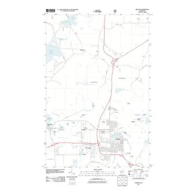
2011 Map of Virginia
USGS Topo · Published 2011About this map
Virginia and the Mesabi Iron Range landscape appear here in the early 21st century, defined by a dense concentration of open-pit mining operations and residential clusters. The terrain is dominated by massive earthwork features such as the Minntac Tailings Basin Cell One and the high point of Lookout Mountain, while the Laurentian Divide runs through the center of the sheet, marking the continental watershed. Local life is centered around Mountain Iron, Parkville, and West Virginia, which sit in close proximity to the industrial excavations of the Mountain Iron Mine and Missabe Mountain Mine. This industrial legacy is etched into the map through dozens of named pits, including the Rouchleau Mine and Alpena Mine, illustrating how the region's geology dictated the layout of transportation corridors like Hoover Rd N and the residential grids of Franklin.
Find a feature on this map
61 named features on this map. Tap any name to fly to it.
Don’t see what you’re looking for? This feature index may not catch every label — zoom into the map to look around manually.
Map Details
Editions of this 2011 Virginia Map
This is the sole edition of this map. No revisions or reprints were ever made.
Other maps of this area

1950 · Mc Kinley
USGS Topo · 1:24,000

1950 · Biwabik NW
USGS Topo · 1:24,000

1951 · Mc Kinley
USGS Topo · 1:24,000

1951 · Biwabik NW
USGS Topo · 1:24,000

1951 · Gilbert
USGS Topo · 1:24,000

1951 · Eveleth
USGS Topo · 1:24,000

1951 · Virginia
USGS Topo · 1:24,000

1951 · Kinney
USGS Topo · 1:24,000

1951 · Kirk
USGS Topo · 1:24,000

1951 · Britt
USGS Topo · 1:24,000
Featured Places
- Virginia, MN
- Mountain Iron, MN
- Brittmount, Mountain Iron
- Hopper, Mountain Iron
- West Virginia, Mountain Iron